


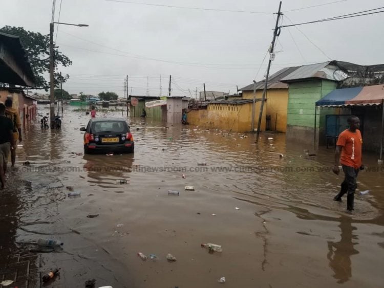
The recurring devastation caused by flooding in Accra, Ghana, demands an immediate and comprehensive response. The Caucus for Democratic Governance, Ghana (CDG-GH) identifies systemic failures in urban planning, drainage infrastructure, and the lack of a cohesive hydrological strategy as the root causes of this persistent crisis. Accra’s vulnerability to flooding is not merely a consequence of heavy rainfall, but rather a complex interplay of inadequate drainage systems, disregard for natural water flow patterns, and a lack of foresight in urban development. The CDG-GH advocates for a multi-pronged approach that prioritizes scientific analysis, strategic planning, and robust engineering solutions to mitigate the devastating impact of future floods and build a more resilient city.
The first crucial step is a comprehensive hydrological and topographical study of Accra. This study must go beyond simply mapping the existing terrain and water bodies. It needs to integrate an analysis of current structural developments, environmental layouts, road networks, and the existing drainage systems. Critically, this study should highlight the discrepancies between the designed capacity of the drainage systems and the actual volume of water they need to manage. This assessment should consider the flow direction and capacity of drains, ensuring that smaller drains at higher elevations feed into progressively larger ones, ultimately leading to rivers or streams. This principle of graded drainage is fundamental to efficient water management and its absence in current practices contributes significantly to the flooding problem. By mapping the city’s topography in conjunction with its built environment and drainage infrastructure, the study can pinpoint areas where current systems are inadequate or counterproductive, providing a foundation for future interventions.
Further enhancing this data-driven approach, the CDG-GH recommends regular aerial surveillance using drones during and after rainfall events. Drone mapping will provide real-time visualization of flood paths, revealing how water flows through the city and identifying blockages or diversions in natural drainage channels. This dynamic information is crucial for understanding the actual behavior of floodwaters, which can deviate significantly from theoretical models. The data collected can be used to create a precise and functional drainage blueprint for Accra, informing the design and implementation of effective flood mitigation measures. This real-world perspective, combined with the hydrological study, will provide a comprehensive understanding of the city’s drainage challenges and guide the development of sustainable solutions.
A critical review of road and highway drainage systems is also paramount. Many existing roads, including major arteries like the motorway, lack adequate drainage at their lowest points, leading to water accumulation and exacerbating flooding. Furthermore, the expansion of roads to 2×4 lanes has not been accompanied by a corresponding increase in the capacity of bridges and culverts, creating bottlenecks that restrict water flow and contribute to localized flooding. Future road designs must prioritize the inclusion of larger, engineered drainage paths and incorporate sufficient subsurface tunnels to accommodate utility services like power and fiber-optic cables, minimizing disruption during flood events. This integrated approach ensures that road infrastructure contributes to, rather than hinders, effective water management.
Based on the data gathered from the hydrological study, drone mapping, and road infrastructure assessment, a holistic drainage masterplan for Accra is essential. This masterplan should identify rivers and streams that require expansion, pinpoint and remove both natural and man-made barriers to water flow, and ensure that efficient flow routes are engineered throughout the city. Learning from international best practices, such as Japan’s innovative approach to river diversion for high-speed rail projects, can provide valuable insights for developing effective solutions. The masterplan should serve as a long-term roadmap for sustainable urban drainage, guiding future development and ensuring the city is better equipped to handle heavy rainfall.
Accra’s coastal location necessitates a thorough assessment of the influence of sea level variations, tidal cycles, and lunar patterns on urban flooding. These factors directly impact the rate at which rivers can discharge into the sea. High tides can restrict outflow, leading to backflow and worsening urban flooding. This coastal dynamic requires a specific set of mitigation strategies. Retention systems, such as strategically located inland dams, could be implemented to temporarily hold excess floodwaters during high tides until they can be safely discharged, reducing the immediate impact on the city. Understanding and mitigating the coastal influence is crucial for developing a comprehensive and effective flood management strategy for Accra.
Addressing the flooding crisis in Accra requires a concerted national effort and the expertise of Ghana’s leading engineers, urban planners, and environmental scientists. This is not merely a local issue but a national challenge that demands immediate attention. The CDG-GH recommends the formation of a dedicated national task force or commission, empowered to oversee the implementation of the recommended actions. This body should be comprised of experts and stakeholders and operate with transparency and accountability, ensuring that the necessary resources and political will are mobilized to address this critical issue. The establishment of a national task force will demonstrate a commitment to tackling the flooding problem and provide the necessary framework for effective and sustained action. This collaborative and focused approach is essential to protect lives, livelihoods, and infrastructure in Accra and build a more resilient future for the city.


")


